Honorable Mention
Miller Roberts, grade 10
Westlake High School, Austin, TX
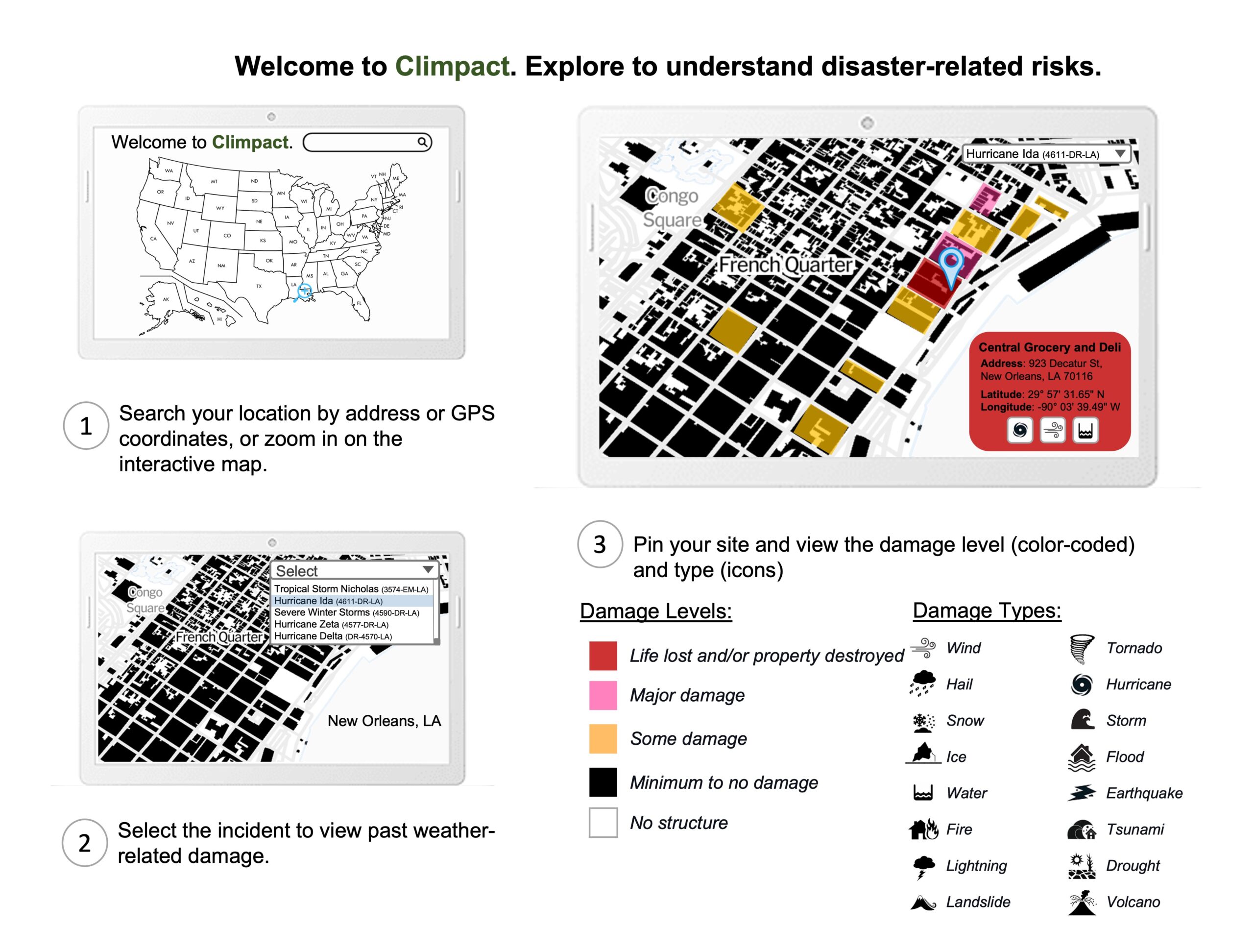
Climpact is an interactive mapping system that allows users to view locations and determine the impact of damage from past major weather-related disasters. I used data from open building footprints datasets in the United States. I looked at FEMA for data on natural disasters from 1953 to today. FEMA also shows information on support provided and scale of damage for natural disasters. In Climpact, you can select a location to update the map and display sites in the area and a related disaster list. Picking an incident refreshes the map to reflect the level and type of damage with color coding and icons. For example, choosing Hurricane Ida shows Central Grocery in red with the relevant icons. Users worldwide can make better decisions on where to live, study, work, and visit. Businesses and governments can determine where to invest and promote growth. They can also help deter people from moving to a specific area. Climpact increases climate change awareness by allowing users to interact easily with geospatial and weather event data.