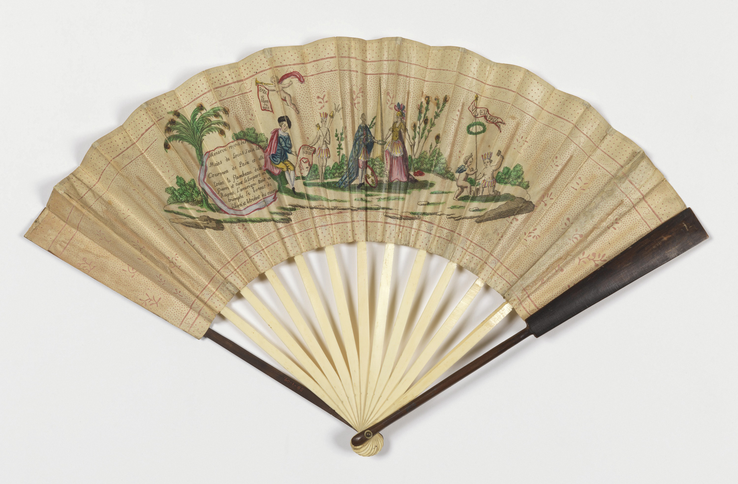
This fan commemorates in an interesting moment in early American foreign policy. During the eighteenth century, amidst the feverish rivalries of the European state system, various nations competed to dominate the world’s oceans. After the United States achieved independence, its political leaders championed the view that the seas should be free and common to all...
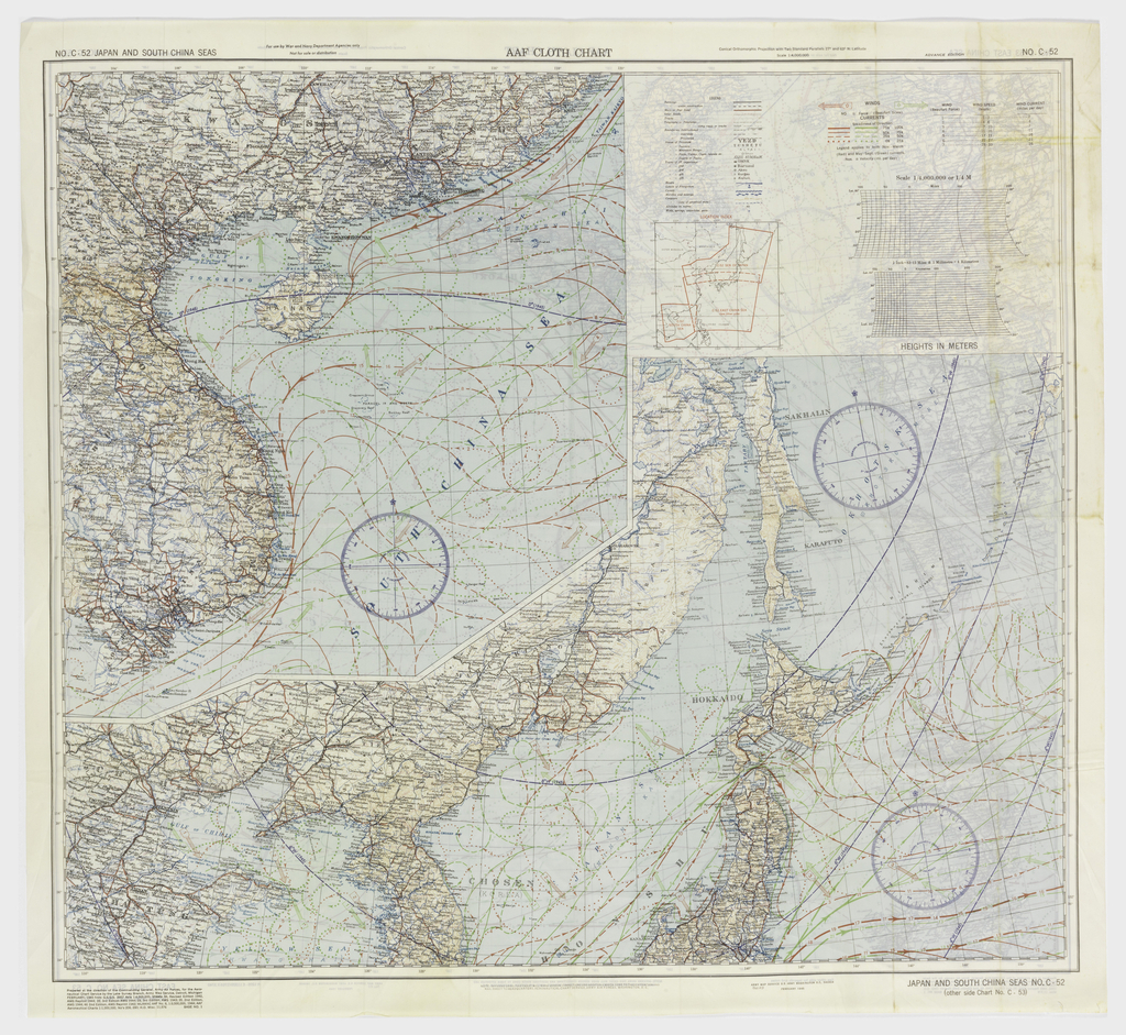
“Escape and Evasion” maps were given to airmen during World War II to avoid capture behind enemy lines. Such maps were one of many in the military man’s arsenal, but in some respects this navigational tool represents one of the most significant products of war-era ingenuity. This Pacific Ocean “drift map,” scaled at 1:4,000,000, illustrates...

Over the next months while the Design with the Other 90%: CITIES exhibition is on display at the United Nations Headquarters in New York several individuals whose own research explores the exhibition’s subject matter have been invited to write blog entries sharing their insights, related research and projects. – Cynthia E. Smith, Curator of Socially...